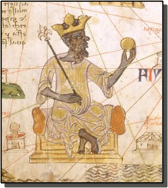


Timbuktu, also spelled Tombouctou, is a city in the West African nation of Mali. Timbuktu, in French ("Tombouctou") means "well of the woman named 'Bouctou'". And "Bouctou" is a word that means, "belly button". Timbuktu began as a trading city, but in time the developed into the intellectual and spiritual center of West Africa. By 1330, Timbuktu became part of the kingdom of Mali. King Mansa Musa built a great mosque, or Islamic temple, in Timbuktu. The mosque attracted scholars from as far away as Saudi Arabia.
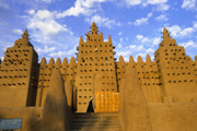
Timbuktu was founded about AD 1100 as a seasonal camp by Tuareg nomads. After it was incorporated within the Mali Empire, probably in the late 13th century, the Mali sultan, Mansa Musa, built a tower for the Great Mosque (Djingereyber) and a royal residence, the Madugu. Shortly after this the city was annexed by the Mossi kingdom of Yatenga, but when the North African traveller Ibn Battutah visited in 1353, he found it again governed by Mali.
In the 14th century Timbuktu became an important focal point of the gold-salt trade. With the influx of North African merchants came the settlement of Muslim scholars. It made little difference that the Tuareg regained control of the city in 1433; they ruled from the desert, and, though they plundered periodically, trade and learning continued to flourish.
In 1468 Timbuktu was conquered by Sunni Ali, the Songhai ruler. He was generally ill-disposed to the city's Muslim scholars, but his successor--the first ruler of the new Askia dynasty, Muhammad I Askia of Songhai (reigned 1493-1528)--reversed the policy and used the scholarly elite as legal and moral counsellors. During the Askia period (1493-1591) Timbuktu was at the height of its commercial and intellectual development. Merchants from Wadan, Tuwat, Ghudamis (Ghadames), Augila, and the cities of Morocco gathered there to buy gold and slaves in exchange for the Saharan salt of Taghaza and for North African cloth and horses. The city's scholars, many of whom had studied in Mecca or Egypt, attracted students from a wide area.
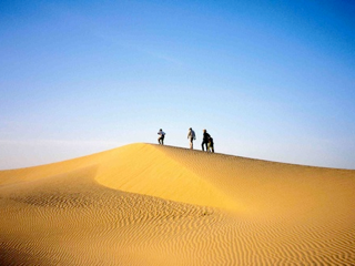
Timbuktu is now an administrative centre of Mali. Small salt caravans from Taoudenni still arrive in winter, but there is no gold to offer in exchange, and trans-Saharan commerce no longer exists. Although there is air service, the city remains most easily accessible by camel and boat. Islamic learning survives among a handful of aging scholars, and a Lyc e Franco-Arabe teaches Arabic to the younger generation.
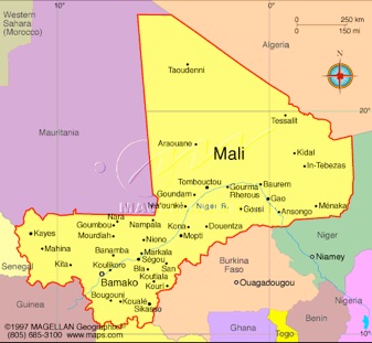
Mali, the largest country in West Africa, is bordered by seven other states: Algeria lies to the north and northeast, Niger to the east, Burkina Faso to the southeast and, with the Ivory Coast, to the south. On the west are Senegal and Mauritania. It is shaped a bit like a butterfly, leaning to the northwest, with a much smaller left than right wing. The larger northwestern region of the country, which extends into the Sahara, is almost entirely arid desert or semidesert. In the central region, known as the Sahel, life follows the Niger River's annual flood cycle, with high water between August and November. In the southwestern area, rainfall and rivers are more plentiful, and this region is marginally more lush than the rest of the country. Although most of Mali experiences only negligible rainfall, the 'rainy' season in the south extends from June through September.
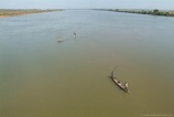
Mali's single most important geographic feature is undoubtedly the great Niger River, which traverses both the Sahel and the southeastern section of the country. The Niger, like the Nile, is both a critical source of sustenance and a major transportation artery--and in this latter capacity it is an excellent venue for boat travel.
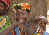
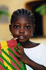
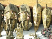
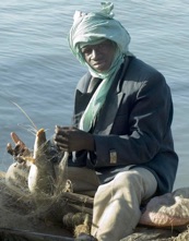
Mali's population comprises a number of different peoples, including the Bambara (who are the largest single segment), the Songhai, Mandinka, Senoufo, Fula, and Dogon. The last of these groups, the Dogon, are world-renowned for their artwork, and a visit to their traditional cliffside villages is a fascinating experience. The majority of Mali's people are Muslim, and the official language is French. Bambara, however, is spoken and understood by almost everyone.